Trending Searches

    History

      Clear All
      LeadNav GPS

      LeadNav GPS

      • Sizes: 133.32MB
      • Version: 6.13
      • Update: 2022-04-08
      Install by Apple Store

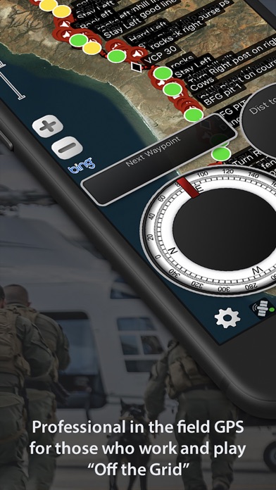
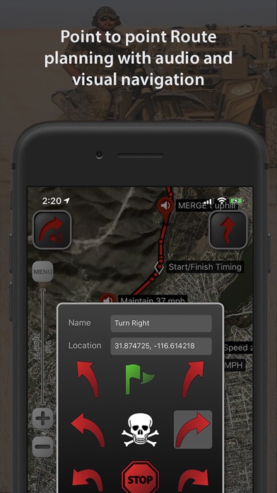
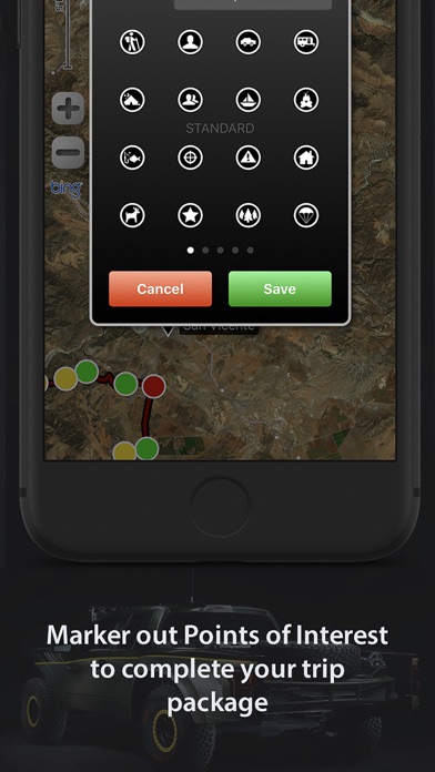
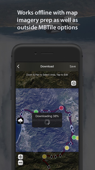
      LeadNav GPS Description

      Mission Planning, Coordination, Communication and GPS Navigation for those who Work and Play "Off the Grid” Built by operators for operators, with decades of experience leading technology innovation in the field. Focused on mobility into dismounted foot patrol operations, LEADNAV currently provides full mission packages in the form of Software, Hardware, Training and Consulting for those operating in some of the harshest conditions and environments imaginable. Used by many, to include off-roaders, security and response teams and other Professional Organizations World Wide! More Powerful than any other GPS on the Market! Features: • Plan, Organize, Coordinate and Execute Trips, Events and other Professional Operations. • Create or Import Collections of Routes, Tracks, and Markers for different events. (Baja 1000 2019, Mining Expedition 2020) • Share individual Routes, Tracks, and Markers amongst your Team or Group. • Easy to use point to point Route Planning Interface. Plan your route and go! • Drop audible warnings and non-audible Serpentine points to keep you on track. • Record tracks to display where you have been. So you can hit the trail again or find your way back. You can also convert your tracks to routes. Track Stats for each trip. • Highly advanced Team Location Tracking through our cellular/wifi, preprogrammed Iridium GO! units (Satellite device and our service plans) and other specialized equipment under contract. • Reverse your routes. Hike to the top and then reverse the route to hike back down! • Drop Markers to identify places of interest or to document the experience as you go. Vehicle, rally point, boat dock, deer, or anything else you want to find again. • System functions on the GPX file standard • Free online Map Sources include Bing, OpenStreetMap, USGS Satellite and USGS Topo • Support of offline mapping options like MBTiles and overlays with our Pro Pack subscription and contracted services. • Subscriptions allow access to additional features and maps (Mapbox Satellite, Mapbox Terrain, Mapbox Streets), and access to your own URL entry (Part of the Pro Subscription). Create, cache, and delete maps with your custom URLs. *Maps subject to change by the providers • Offline Mapping for areas with no cellular coverage. (yearly subscriptions) Select and store desired areas of the map for offline use. Download those maps before you go in the field! • Compatible with Bluetooth headsets and speakers for eyes free navigation. Throw your device in your pack and GO! • Voice Prompts automatically adjust for the current speed. Siri now reads the waypoint label names as you navigate. “Big freaking rock on the left!” Get creative with the names to make the most out of your experience. • Automatically adjusts your audible (Red) Turn Warning and (Blue) Waypoint Proximity rings based off of your current speed. Giving you the information you need when you need it. Audio Guidance Examples: “Slight Left in 450 meters” ...... “Slight Left” “Danger in 500 meters” ....... "Danger" ————————————————— Additional In-App Purchases: (See website for all subscription details) - Advanced Pack Subscription (recommended for those on foot covering smaller areas) - Pro Pack Subscription (recommended for those in vehicles covering larger areas or needing our more pro level features listed on our website) - Recon Markers - Hunting Markers - Aviation Markers Note: • This is a high powered GPS device and requires power connectivity for prolonged use in the field. • Mobile devices that are WiFi only do not come with an internal GPS. An external GPS will need to be used along with the application. • The capability to save satellite maps/imagery to your device for "off the grid" use is an outside service and requires a yearly Subscription Battery Life Disclaimer: Continued use of GPS running in the background can dramatically decrease battery life.

      LeadNav GPS Information

      Name LeadNav GPS

      Category Navigation

      Developer LeadNav Systems LLC

      Version 6.13

      Update 2022-04-08

      Languages EN

      Size 133.32MB

      Compatibility Requires iOS 11.4 or later. Compatible with iPhone, iPad, and iPod touch.

      Other Original Version

      LeadNav GPS Screenshot

      LeadNav GPS
      LeadNav GPS
      LeadNav GPS
      LeadNav GPS
      LeadNav GPS
      LeadNav GPS
      LeadNav GPS

      Rating

      4.6

      440 Ratings

      Tap to Rate

      Please use Safari on iPhone/iPad to access the current page

      Because Panda Helper VIP service is based on iPhone/iPad device information (UDID), please access the current page in Safari on iPhone/iPad:
      • Scan the QR code on your iPhone/iPad
      • Copy the link below and open it in Safari on your iPhone/iPad
      * Safari only. Other browsers cannot get device information
      copy successfully!

      Follow us on social media

      panda helper top hover